


|
|
|
|
|
|
|
|
along the route Dovšska Vratica - Pogačnikov Dom. Commonly occur so called "kotlici" (kettles) with vertical walls and flat wide bottoms. Their depths attain ten to twenty meters, and are similar to their diameters. Their bottoms are usually covered with snow and ice. The greatest concentration of kotlici, often interconnected, is found on Kriški Podi and on the large roche mutonee with closes the valley below the Razor. Numerous are modified by dissolution grooves, often more than one hundred metres long and up to several tens of metres deep. The grooves occur mainly west of Zgornje Kriško Jezero and below the valley under the Razor and they are closely linked to the young tectonic fractures. Several open tectonic fractures, 2-3 m wide have been explored in the bottom of the valley below the Razor. They attained 30 m in depth and the degree of their solution widening is minimal.
Numerous karst depressions were found near the Razor-9 cave (the highest entrance at 2350 m). The depressions are filled with terra rossa and calcite crystals up to 20 cm long. Decaying remnants of old calcitic crusts were found in the entrance series of Razor-9. They were the only speleothems found in the caves we discovered.
There are no surface streams in the exploration area. Traces of short streams were found above Zgornje Kriško Jezero and over Srednje Kriško Jezero. Rainfall water is rapidly disappearing in ponors. Old, now blocked ponors were found in the wall above Srednje Kriško Jezero. They drained the cirque of the Zgornje Kriško Jezero towards the south, that is to the Spodnje Kriško Jezero lying more than 100 meters lower.
No permanent waterflows were found in the discovered caves. Clays laid down by waters flowing from the deepened cirque of the Srednje Kriško Jezero were found in the deepest cave (- 240 m) KP-1 and in short lateral series at the depths of 110 m and 150 m.
The Kriški Podi area is most probably drained by a deep vertical flow to the Krajcarica resurgence which lies 2-4 km southwest of the exploration area, at the altitude of 700 m. The northern part of the valley below the Razor falls to the north with a wall several hundred metres high and the drainage in this direction is very likely. A primary drainage of the razor to the west, to the valley and resurgence of Mlinarica, cannot be ruled out. This may be indicated by the entrance series of the Razor-9 cave.
Most searched caves, regardless of the elevation of the entrance, have ice plugs, some of them checked by us to be at least 70 m deep. Among the explored caves only two may be considered deep ones (KP 1 -240 m, KP 7 -193 m). Both terminate in wide pitches with floors covered with thick layers of rocks with draught. Several caves are up to 100 m deep (R-1A, B, KP-2, DP-3). Most caves are single pitches or fractures less than 40 m deep. They usually terminate in ice plugs. It seems that the main exploration problem in this area is the strong deformation of the surface and the old ways of karstic circulation by young tectonic movements, which conceal the access to the deeper parts of the caves.

|
|
The Monti Jerzy Pukowski Speleoklub Bielsko-Biala The contacts of Klub Taternictwa Jaskiniowego in Bielsko-Biala with Italian caving clubs date from the mid eighties when we were in Spluga della Preta, a nearly 900 m deep cave in the Venetian Alps. It should be added that we were accompanied by our colleagues from Czech caving clubs. It was due to the contacts of ORCUS club in Bohumin that we could organized another expedition to Italy. |
 A polish team in Monti Musi |
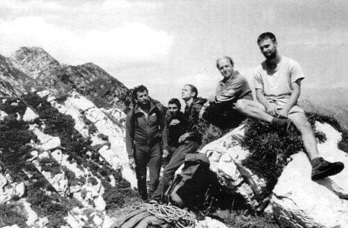
On 9 to 19 August 1995 our team of six worked in the Monti Musi (the Julian Alps) massif situated southwest of Tarvisio in Italy, near Udine. Lubomir Zawierucha was the leader and Jerzy Ganszer, Bla3ej Nikiel, Michal Smoter, Pawel Wieczorek (now a member of our club) and Jerzy Pukowski, the author of this textw were the members of the team. We were invited by colleagues from Gruppo Speleologico "San Giusto" of Trieste. Having visited this town we spent several hour on a naturist beach, we went to the mountains.
The Monti Musi, culminating at the altitude of 1878 m extends in the eastwest direction for almost 12 km above the Resia river valley. About 15 km to the norheast rises the Monti Canin. Only ten kilometres to the north runs the motorway from Tarvisio to Udine. The difference in altitude in the massif attains 1300 m. Cave entrances occur up to 1800 m, while known resurgences lie at the altitude of about 600 m.
The working area of our expedition lies at 1500-1600 m. In immediate vicinity of our base camp was the entrance to the then deepest cave in the massif - Abisso Roberto Pahor, 485 m deep.
On the first day three of us visited with a group of Italians a 250 m deep cave X6. The others were busy with prospection for new entrances. As a result we found 34 new caves, the biggest one was 61 m deep and 152 m long.
Though not terminated with a major success, this expedition introduced us to a new, little known in Poland, area of potential exploration. Though not bound to bring out sensational discoveries, the mountains are interesting and any caver may have here his or her "great days", exploring a cave that in world scale would not count, but if it were in the Tatra...
|
|
|
|
|
|
|
|
|